|
About Chiang
Mai
|
(You are listening to "Phleng Chat", the
Thai Anthem) |
 |
|
History
Location
Time
|
 |
Topograph
Weather
|
| Chiang Mai is often referred to as
"The Rose of the North" |
Wat Phra That Doi Suthep
(A Temple Near the Summit of Mount Suthep) |
There are about 300 temples in and around Chiang Mai |
|
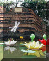
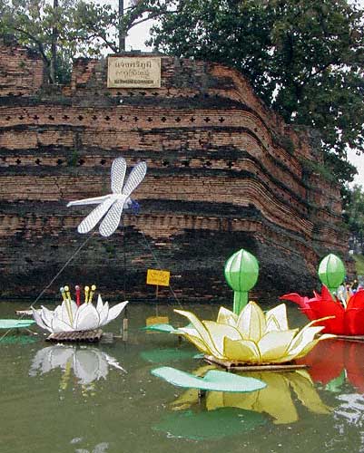
(The
Northeast corner of the wall protecting the old city of Chiang Mai) |
Chiang Mai is an ancient city founded in the12th century.
Chiang Mai City’s population today is about 200,000. The
city was established in a green and fertile valley near the River Ping,
with beautiful mountains to the west. The old city was protected
within a fortress-like wall and a moat. Today the wall
still exists in some places. The interior of the old city is exactly
one square mile, the length of each side of the wall being one mile. |
(The old city of Chiang Mai within the protective walls and a moat) |
|
This page
was last updated on
06 Sep 2010
|
|
|
|
| |
History
of Chiang Mai
Chiang
Mai’s rich history goes back hundreds of years. From ancient
times, communities were set up along the major rivers, -- the rivers
Kok, Ing, and Ping.
In
the 12th century, King Mangrai, united the many communities in the
basins of the Rivers Kok and Ping and founded the city of Chiang Mai
as the capital of the new kingdom, known as Lan Na.
Lan
Na’s sovereignty was lost to Burma in
1558. The city was
abandoned to the jungle and remained deserted until the late 18th
century. With the help of the King of Siam (now Thailand) the
city was revived in 1796 and reverted to Siam sovereignty. The
city and it’s surrounding area became a province of Thailand in
1933.
Today,
the city of Chiang Mai has existed for over 700 years and is the
oldest continuously inhabited city in Thailand. The blend of
culture and customs of the various ethnic groups that have lived in
Chiang Mai has been preserved and passed down through generations to
form a distinct identity.
Back
to top of Page
|
|
|
Back
to top of Page |
Location
Chiang
Mai Province constitutes the upper area of Thailand’s northern
region, 750 kilometers (469 miles) from Bangkok.
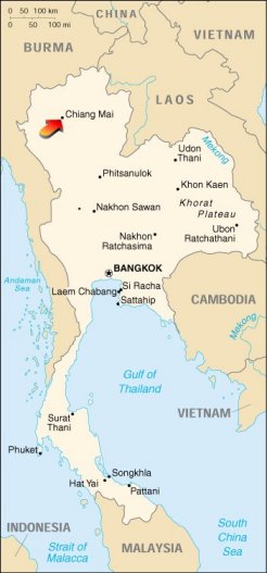
(Map
courtesy of the CIA)
http://www.odci.gov/cia/publications/factbook/index.html
|
|
|
|
Topography
About
80% of Chiang Mai Provience’s land is covered by mountains and
forests. The largest and most important river in the
providence is the River Ping. The Ping originates in the
mountains north of Chiang Dao and flows southward for 540 Km (338
Miles). The highest mountain in Chiang Mai Providence is also
Thailand’s tallest. Inthanon Mountain peaks at 2,565 meters
(8,498 ft.).
Back
to top of Page
|
|
|
Weather
In relation to
the rest of Thailand, Chiang Mai is considered to be quite cool.
The average yearly temperature is 25.4°C (78°F), with the highest
temperature ever recorded being 40.1°C (104°F) and the lowest 8.7°C
(47°F). There are three basic seasons in Northern Thailand:
Hot, Rainy, and Cold.
Back
to top of Page
|
|
|
|
|
Chiang
Mai Time
Chiang Mai is +7 UTC
(Coordinated Universal Time) or ZULU time. All of Thailand is
in the same time zone as Hanoi, Saigon, and Jakarta. Thailand is 12
hours ahead of Eastern Standard Time, but when the U.S.
is of the insane delusion of thinking they are "saving" one hour
of daylight, we are 12 hours
ahead of Central Daylight Time.
Back
to top of Page
|
|
|